English
0 item(s)
View cart
You have no items in your shopping cart.
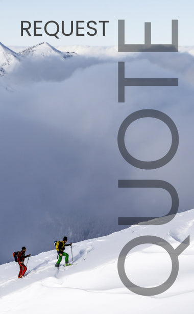
Adventurers all over the world feel the lure of the mountains. There is nothing like ascending a peak, rising to the challenge of climbing to the summit and feeling the cold, clean air far above the world. Some climbs are easier than others, but all are an incredible experience. Check out our list of the top five peaks for mountaineering, complete with information on the satellite network to rely on for communication in each area. Satellite phones are a vital piece of equipment for mountaineers of any skill level.
Located in Tanzania, Africa, Mount Kilimanjaro is an enormous, flat-topped extinct volcano with three individual volcanic cones, Kibo, Mawenzi, and Shira. It is the biggest mountain in Africa and climbing it will take you through several different climates, from lowland forests to high desert. The summit is a peak called Uhuru and is located on the edge of the Kibo crater.
Kilimanjaro is considered a fairly easy climb and doesn't require a lot of extra equipment. It's great for beginning climbers as long as you're already in good physical shape. At 19,330 feet high, though, scaling the peak of Uhuru is still nothing to take lightly. To keep connected during this climb, the best satellite phone would be on the Thuraya network.
The Matterhorn is an iconic peak in the Alps right on the border of Italy and Switzerland, and reaches a height of 14,692 feet. The mountain rose from the collision of two tectonic plates, so it's roughly pyramid-shaped, with four sides. As an extremely popular climbing destination, the Matterhorn has several fixed routes up to the summit, including permanent ladders and other equipment.
The Matterhorn offers a few different climbing difficulties depending on which side you scale. Beginning climbers can take popular, proven routes with the permanent fixtures mentioned, while advanced climbers can approach the mountain from another route. Either way, climbing the Matterhorn is a worthy and sought-out achievement for a mountaineer. Thuraya is a solid choice for a satellite network in this area as well.
Denali is the name given to this towering mountain by the indigenous Athabascan people of Alaska, and at 20,320 feet it's easy to see how it would earn such a name— Denali means "the High One." Located in the Yukon Mountain Range at the heart of Denali National Park and Preserve, the highest peak in North America stands as an incredibly challenging climb among icefalls and glaciers.
Most of the difficulty in climbing Denali comes from the extreme weather that batters the mountain. Avalanches are a threat during the majority of the year as well, with May and June being the best months to attempt a climb. Even during these prime months, Denali is a major challenge for even expert mountaineers. An Iridium satellite phone would be your best bet in this location.
The highest point on the Earth and the crown jewel of the Himalayas, Mount Everest touches the stratosphere at 29,035 feet above sea level and is so tough to climb that you need a permit from China or Nepal to even attempt it. Hazards include powerful wind and weather, bitter cold, avalanches, and even a crippling lack of oxygen as you ascend to what mountaineers call the "death zone," where the altitude is too high to sustain human life for long. The native Sherpa people have adapted to this harsh land over generations and are considered without a doubt the best climbing guides to be found.
Regardless of the danger, the challenges of Everest only serve to awaken the sense of adventure felt by extreme mountaineers in pursuit of a dream to fight their way up to the tallest peak in the world. Reaching the summit is a lifelong dream attainable by only the most dedicated climbers willing to risk their lives. Thuraya and Iridium are both good choices for communications on Mount Everest.
Known as the Savage Mountain, K2 lives up to that name as a peak conquerable only by the most ambitious climbers. Located in the Karakoram Range northwest of the Himalayas at the border of Pakistan and China, K2 is not quite as tall as Everest (reaching a height of 28,251 feet), but it's much steeper and harder to climb. Even reaching the mountain is a challenge, as K2 is so remote that it doesn't even have a local name— although Chhogori (Balti for "big mountain") has been suggested, and it's sometimes called Mount Godwin-Austen. The only name that has stuck, however, is the ominously-technical-sounding surveyor's mark K2.
In addition to its steep grade and presence above altitudes that can sustain human life, K2 is also home to frequent avalanches, rock falls, and unpredictable weather. Its remote location also presents problems, as the mountain itself can only be reached after an 8-day hike and there's nowhere within 200 miles to restock supplies. K2 is emphatically not a mountain to be attempted by anyone but the most prepared and experienced of mountaineers. Thuraya and Iridium are both supported in Pakistan but keep in mind that Thuraya service is not permitted in India and there is some question that K2 falls into Indian jurisdiction.
Planning a mountaineering journey is a big endeavor that can be intimidating and should never be taken lightly, but it can lead to the most rewarding experience of your lifetime. Just make sure you account for every risk and have plans in place for every contingency. This includes having a means of communication— a satellite phone can save your life in a place with zero margin for error. Outfitter Satellite both sells and rents the vital equipment you need for your adventures. Please contact us for more information.